ORIGINAL Building ~1899-1963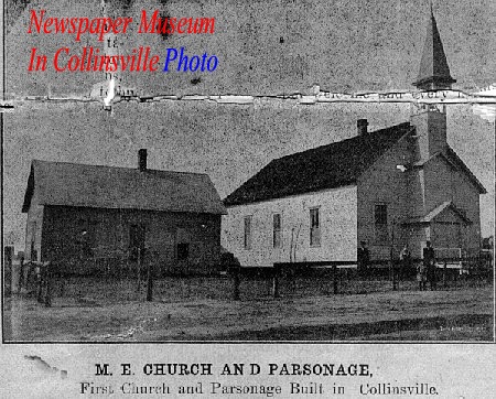 See location 1 on maps below.
|
PRESENT Building 1963-200?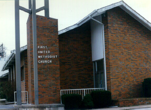 See location 2 on maps below.
|
FUTURE Building 200? See location 3 on maps below.
|
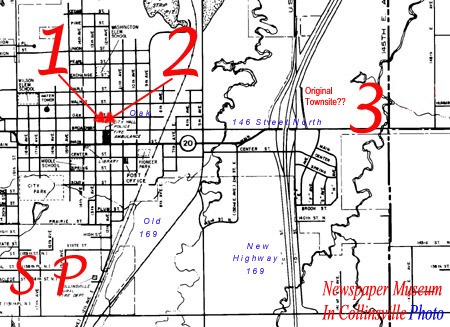
Collinsville, Oklahoma Overview Map (1997)The original Collinsville townsite was located approximately a mile and a half East of the current city before ~1900. The future Collinsville First Methodist Church will be near that old townsite East of New Highway 169 and North of 146th Street North. The original and present Methodist Church buildings are located 2 blocks North of City Hall/Main Street (on Oak Street between 12th and 13th). |
||
 See location SP on map above.
1919 Sanborn Insurance Map of South Park M.E. ChurchDuring the time Collinsville had an expanded population (up to ~8000 people) when the zinc smelters were active (~1911-1918) a large portion of Collinsville's people lived on Smelter Hill where this "other" Collinsville Methodist Church was located. More research is required to determine when the church started and ended. |
See locations 1 & 2 on map above.
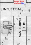
1919 Sanborn Insurance Map of First M. E. Church 1/2 block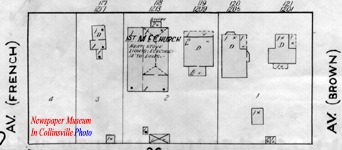
The M.E. Church detailed in 1919 is the original building with expansions to the West and South. The house (parsonage) next door to the right (East) is the approximate location of the present day church building. This half-block faces North to Oak Street between 12th (formerly Brown Ave.) and 13th (formerly French Ave.). |
|